
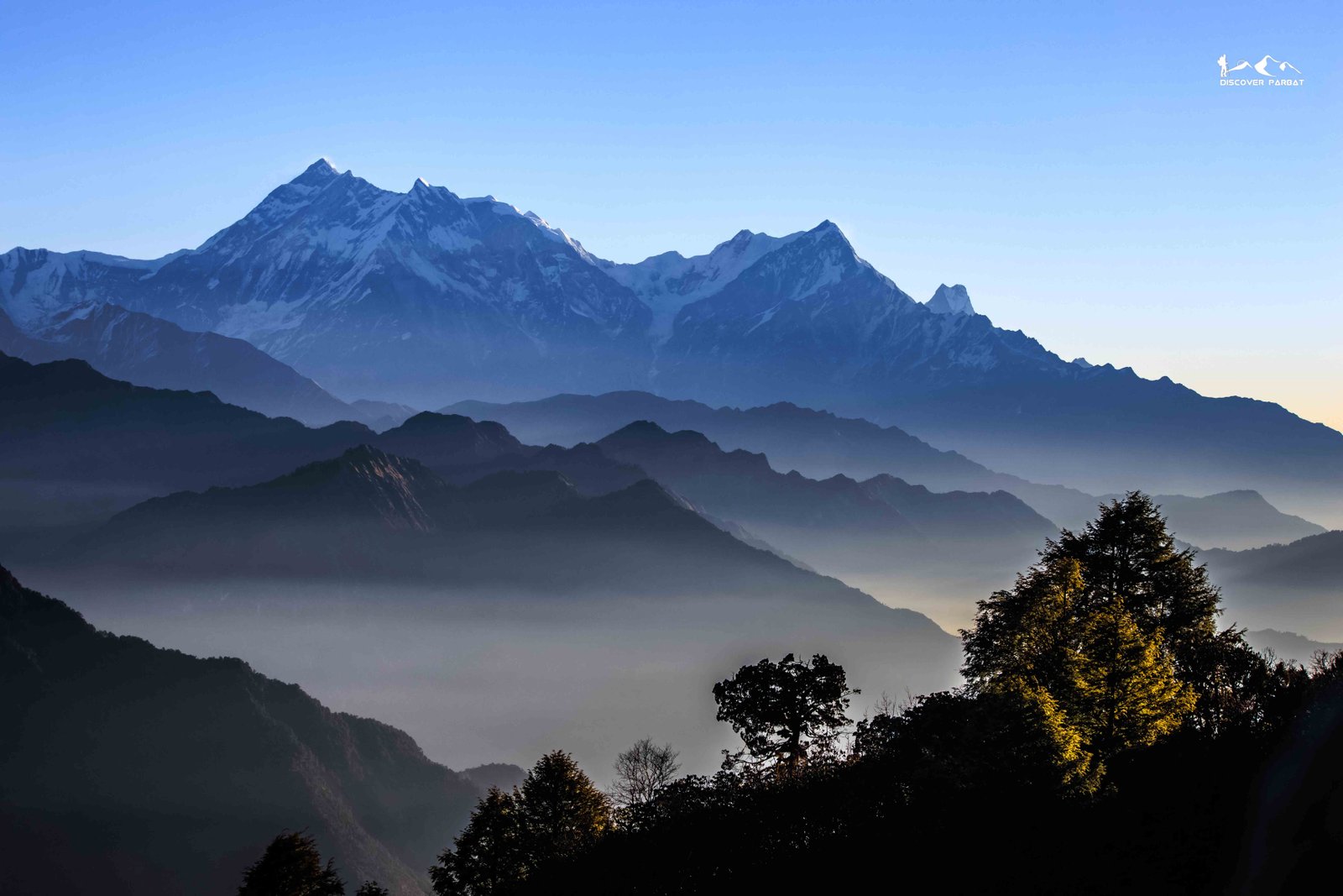
Witness the western side of Dhaulagiri Range through the untouched trails of Dhorpatan Hunting Reserve


The Dhorpatan Jaljala Gurja Circuit Trek is a journey into one of western Nepal's least-explored corners, where vast highland grasslands, remote settlements, and sweeping Himalayan panoramas remain largely untouched by mass tourism. Centered around Dhorpatan Valley, home to Nepal's only hunting reserve, this 8-day trek offers a rare combination of wilderness, culture, and camping adventure far removed from the busier trails of the Annapurna and Everest regions.
The trek begins with a scenic drive from Pokhara to Dhorpatan via Kushma, Baglung, and Burtibang, descending you into a wide valley ringed by forested hills. A full acclimatization day at Dhorpatan follows, giving you time to explore the valley at a relaxed pace, including a visit to the local museum that offers insight into the region's history and the hunting reserve that once drew royalty and dignitaries. From here, the trail climbs steadily to Bukipatan at 4,000 meters, one of the trek's true highlights. An additional acclimatization hike from Bukipatan rewards you with uninterrupted views of the Dhaulagiri range, including Dhaulagiri I, Gurja Himal, Mukut Himal, Churen Himal, and Outha Hiunchuli. The vast open patan, or grasslands, surrounding Bukipatan are transformed in the monsoon into a sea of wildflowers grazed by thousands of sheep, making this one of the most visually striking stretches of the entire circuit.
From Bukipatan, the route descends back toward Dhorpatan before climbing again to Gurjakhani, a seasonal settlement used by herders in the warmer months and left empty through winter as families return to their home villages. The trail then continues to Jaljala, arguably the trek's finest viewpoint, where an unbroken panorama unfolds across Dhaulagiri, Annapurna I, Annapurna South, and the iconic Machhapuchhre (Fishtail), layered above rolling hills. Accommodation through this stretch stays simple and close to nature — a homestay in Dhorpatan gives way to nights in tents and mountain huts, adding an authentic camping element that few other treks in Nepal still offer.
The journey continues to Rughachaur, another expansive highland grassland with sweeping views of both the Dhaulagiri and Annapurna ranges, before descending to Gurja village, the largest settlement of the Chhantyal community in the region. A homestay here offers a genuine window into Chhantyal culture and daily life, a fitting close to a trek defined by remoteness and authenticity. The final day involves a short two-to-three-hour hike followed by a drive back to Pokhara, bringing the circuit to an end.
What sets the Dhorpatan Jaljala Gurja Circuit apart is its solitude. Beyond a modest flow of visitors to Dhorpatan and Bukipatan during the monsoon wildflower season, the trail sees little foot traffic throughout the rest of the year. This is a trek for those seeking an off-the-beaten-path experience — wide-open grasslands, layered Himalayan views, and nights under canvas in some of western Nepal's most peaceful and unspoiled highlands.
If you are looking for a less touristy option
You want more authentic experience
You have a basic level of fitness
You can be comfortable with the altitude around 4,000m
You are looking for comfortable teahouses
You don't want to do camping trek
You get picked up from your hotel at Pokhara and then we start the 7 hrs. drive to Dhorpatan. We pass through the scenic Mid-Hill Highway via Kushma, Baglung and Burtibang. In between, we can have multiple breaks for food and washroom. The road is blacktopped till Burtibang and from then its an offroad drive for the next couple of hours. In between, we can stop to visit bridges around Kushma and Baglung, along with Baglung Kalika Temple.
Today, we adapt to the elevation with an extra day at Dhorpatan. We also utilize this day for exploration around the valley. We walk to Dhorbarahi Temple, Musuem at the office of Dhorpatan Hunting Reserve and explore the local lifestyle as well.
Today, we hike up to Garpachheda which lies in the huge highland grassland of Bukipatan. Initially, it goes gradual uphill for the first couple of hours or so and later, it is a bit steep uphill hike until we reach our camp at Garpachheda. It can take in between 5-6 hrs. of hike.
At Garpachheda, lies a basic camping setup. The food options are also limited with the best option being Dalbhat for dinner. We also go for a short acclimatization hike here as well.
We enjoy the morning view from our camp. After breakfast, we descend down back to Dhorpatan first. We stop for lunch here. Later, we continue our hike to Gurjakhani, following the Uttarganga River. From Dhorpatan, we mostly follow the road so the trail is flat or only gradual uphill.
At Gurjakhani, there is a basic homestay. Its a temporary village as people only have huts here for farming in summer as in the winter, the go back to their vilages in the lower region.
From Gurjaghat, its another 10KM to Upper Jaljala. As our last day, today we also follow the Uttarganga River and the trail is mostly through the road. The landscape gets quite dramatic as we pass through a forest with naked trees, with no branches or leaves as there was a wildfire years back burning down the forest. We gain around 400m in terms of elevation and its mostly gradual.
At Upper Jaljala, there is a small hut serving as homestay. We can also set up tents for accommodation as well.
From Jaljala, we can witness the panoramic view of Dhaulagiri and Annapurna range peaks with layers of hills as well.
After breakfast, we start our hike. Initially, we follow the same trail as yesterday, till just below Lower Jaljala. From there, we take another trail leading towards Rughachaur. The trail goes through pine forest and is steep in some section. Before reaching our camp, we also need to cross a pass of 3,800m.
At Rughachaur, lies a couple of huts used by sepherds during monsoon. We camp just next to the huts.
From Rughachaur, we can see more breathtaking views of Dhaulagiri and Annapurna Range peaks with more layers of hills in the eastern side.
We mostly go downhill today, towards Myagdi Khola(river) valley. The trail goes through the beautiful pine forest. At the end, there is an uphill section for around 30-40 minutes, after crossing the river.
Gurja is a beautiful dense village of Chhantyal Community and is recently connected with road.
We explore a bit of the village in the morning. Later, we drive back to Pokhara via Muna, Darbang, Beni and Kushma. The first half of the drive is mostly offroad with few section of blacktopped road till Darbang. the later half is perfectly paved and comfortable road.
This is a moderate to challenging trek, with the hike to Bukipatan reaching 4,000 meters and several consecutive days spent above 3,000 meters on open, exposed grasslands. Prior trekking experience and a good level of fitness are recommended, along with proper acclimatization, which is built into the itinerary at Dhorpatan and Bukipatan.
The monsoon months (June to August) are actually one of the best times to trek here, as the grasslands at Bukipatan and Rughachaur burst into wildflowers and fill with grazing sheep. Outside of monsoon, the trek offers clearer mountain views and quieter trails, making both seasons appealing depending on whether you prioritize wildflowers or visibility.
Accommodation is basic and part of the trek's off-the-beaten-path charm. You'll stay in a homestay at Dhorpatan and Gurja village, while nights at Gurjakhani, Jaljala, and Rughachaur are spent in tents or simple huts. Trekkers should come prepared for a camping-style experience in the higher, more remote sections.
Yes, since the route passes through the Dhorpatan Hunting Reserve, a permit is required, along with a licensed guide, as this is a remote and less-traveled area without the infrastructure of more popular trekking routes. A guide is also essential for navigation, as the trail is not well-marked and sees very few trekkers outside the monsoon season.